Click on each file to open or download the full version.
Current version: 2.5 (January 2021)
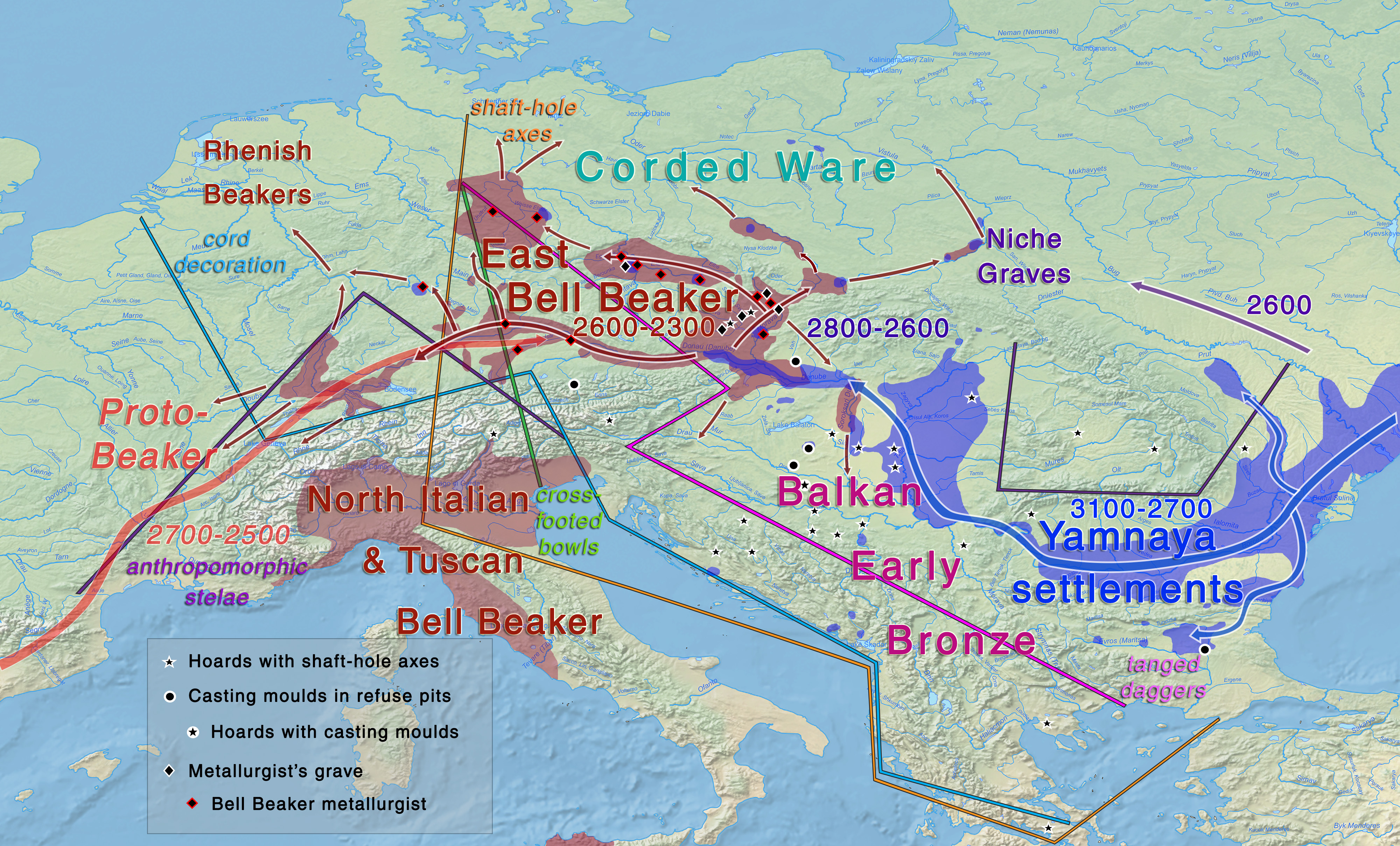
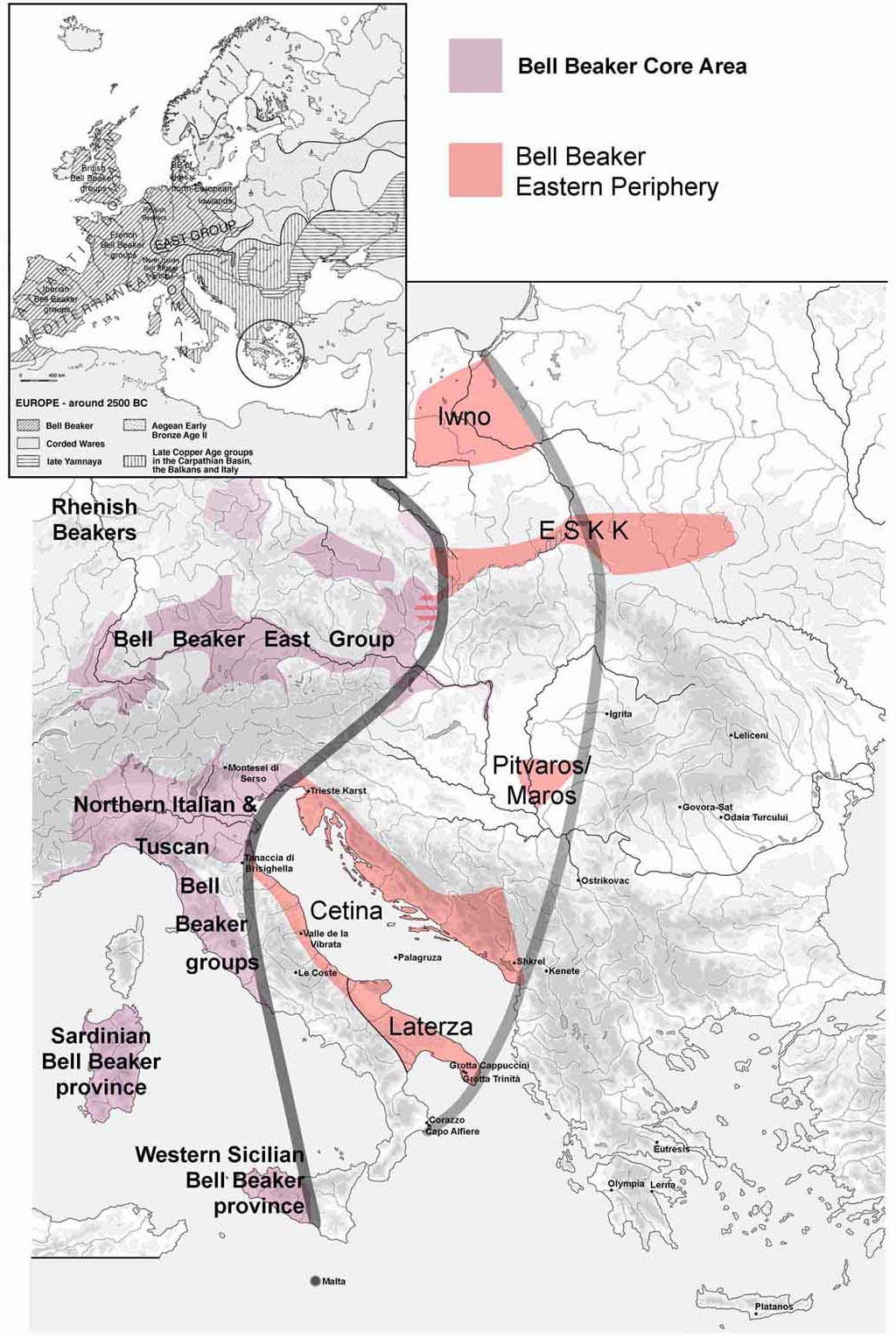
Map of migrations during the Yamnaya – Bell Beaker transition in the 3rd millennium BC, following Volker Heyd (2007, 2013, 2015). See full image.
Current version: 2.4 (May 2020)
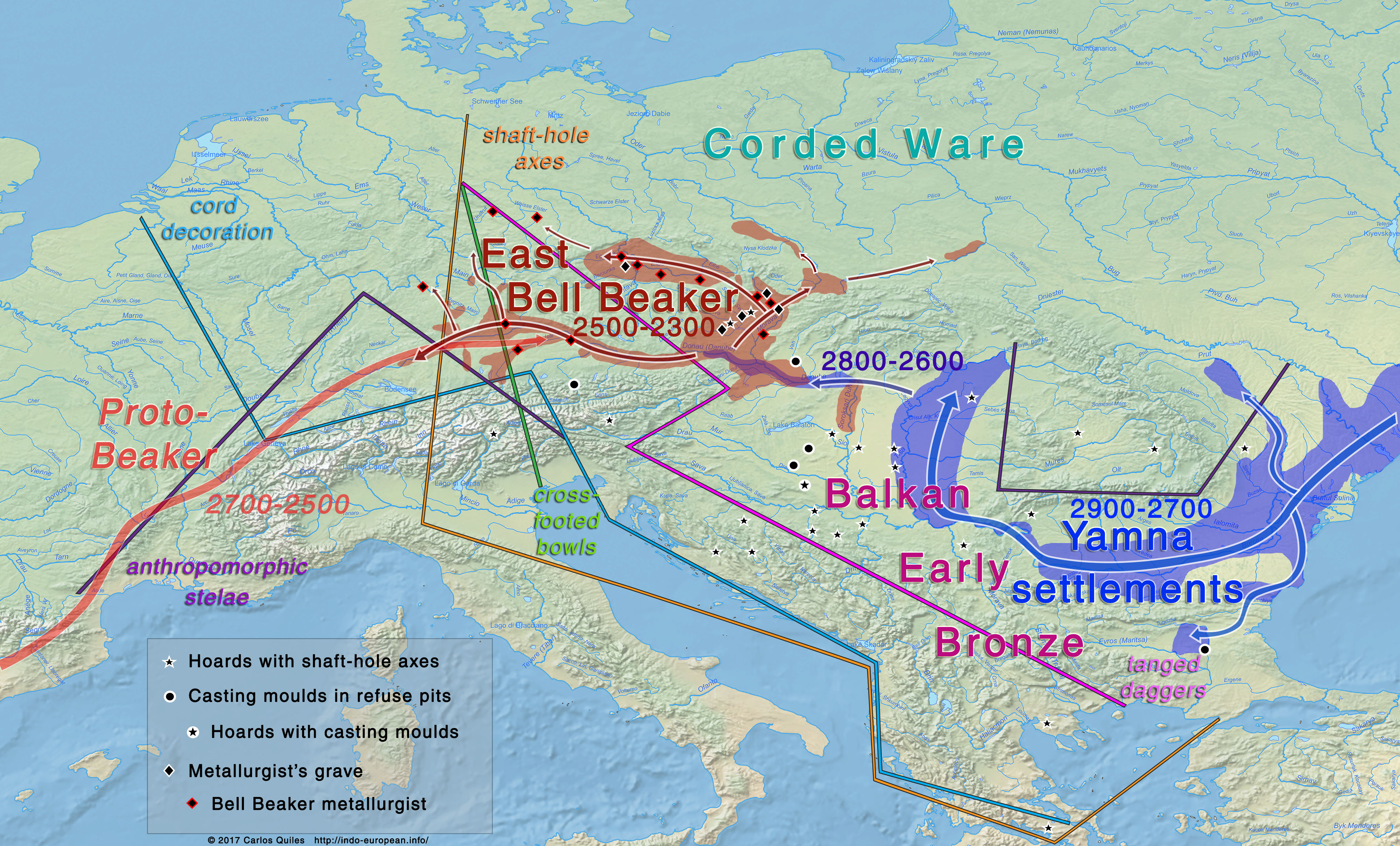
Map of Yamna – Bell Beaker migration. according to Volker Heyd.
Previous version: 2.2 (October 2019)
Map of Yamna – Bell Beaker migration. according to Volker Heyd.
First version: October 2017
Yamna – East Bell Beaker migration 3000-2300 BC
Image based on Harrison and Heyd (2007), Heyd (2007, see below), and other images on local East Bell Beaker expansion.
NOTE. For Yamna expansion into the Carpathian basin, see Yamna Hungary maps.
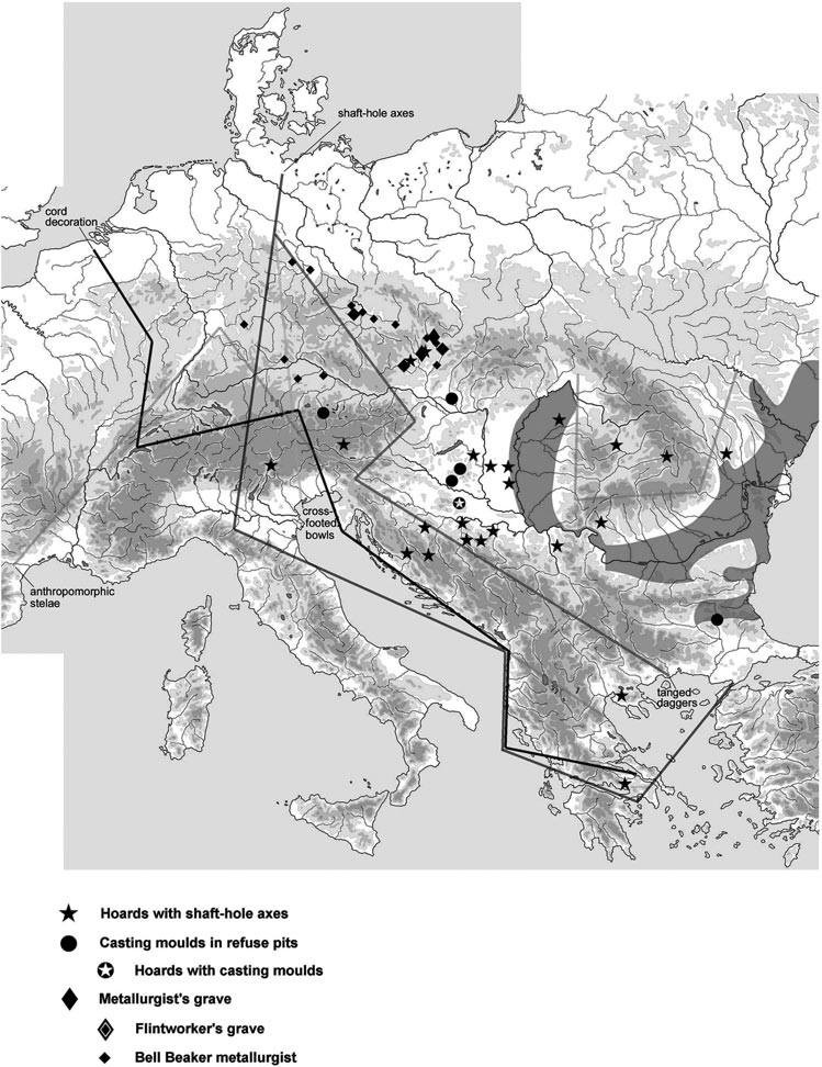
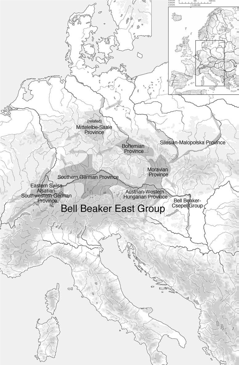
Yamna migration according to Heyd (2007)Infiltration of proto-beaker, and migration of east Bell BeakerDistribution of the Bell Beaker East Group, with its regional provinces, as of c. 2400 cal BC (after Heyd et al. 2004, modified).Bell Beaker core/periphery/margin areas during the Early Bronze Age. Volker Heyd (2007).