These are images from A Feat of Crowds, the fourth volume of the series A Song of Sheep and Horses. This fourth book contains supplementary materials for the other main three books: the first two (A Game of Clans & A Clash of Chiefs) on prehistoric migrations, and the third one (A Song of Sheep and Horses) on Indo-Uralic languages.
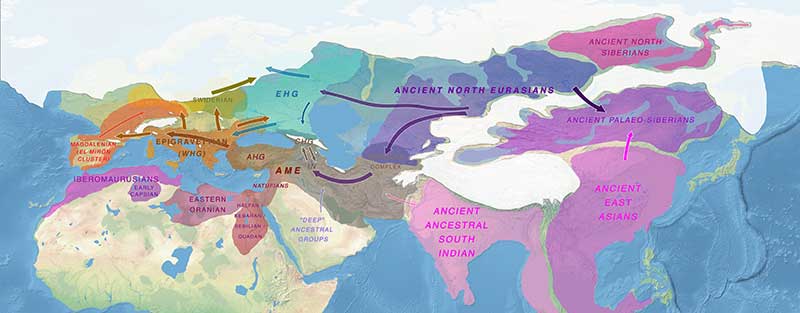
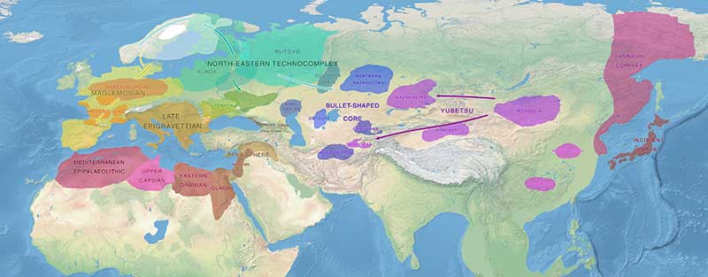
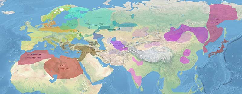
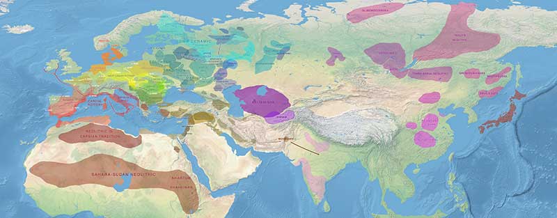
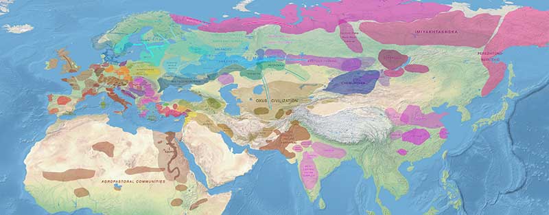
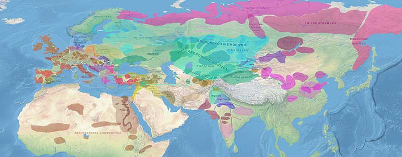
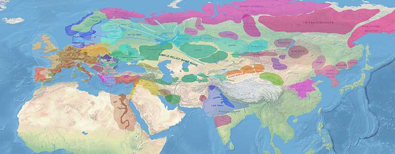
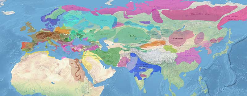
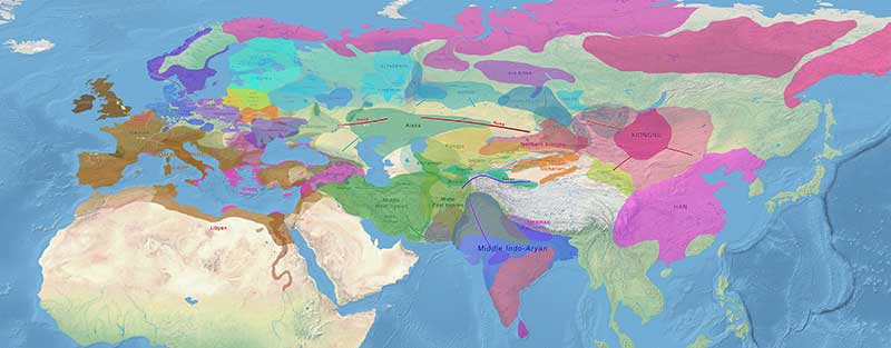
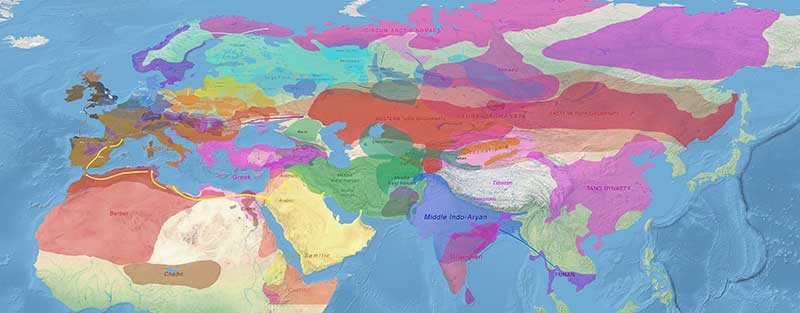
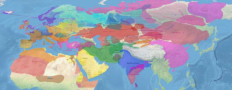
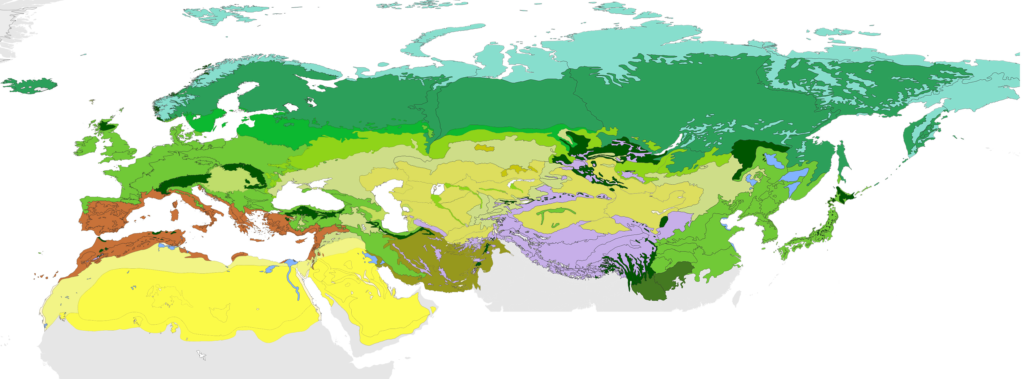
The maps are centered on European prehistory and history, and their Eurasian connections, so the borders of cultures and peoples beyond them – especially South-East Asia and Africa – are more inexact.
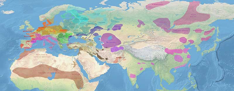
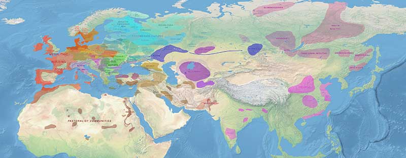
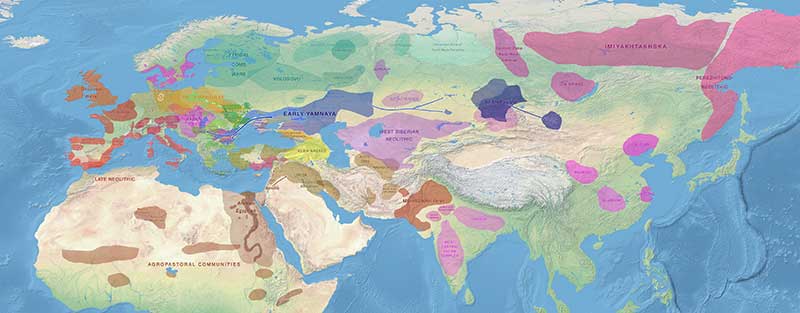
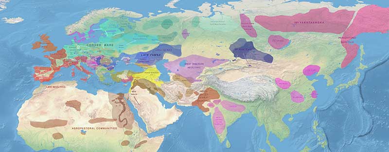
These maps were drawn to illustrate certain points in the aforementioned series of books, so they are diachronic illustrations of different cultures and peoples not exactly contemporary with each other, but often sequential in time. They are thus used to illustrate certain developments, e.g. the Neolithic expansion of farming, or the Chalcolithic expansion from Yamna. In that sense, they are not different from many maps used to illustrate cultural expansions and migrations of peoples.
Please report any errors by writing an email to [email protected], attaching a link, map, article, or book (with pages) for reference – unless it is a clear mistake -, and I will correct them as soon as possible.
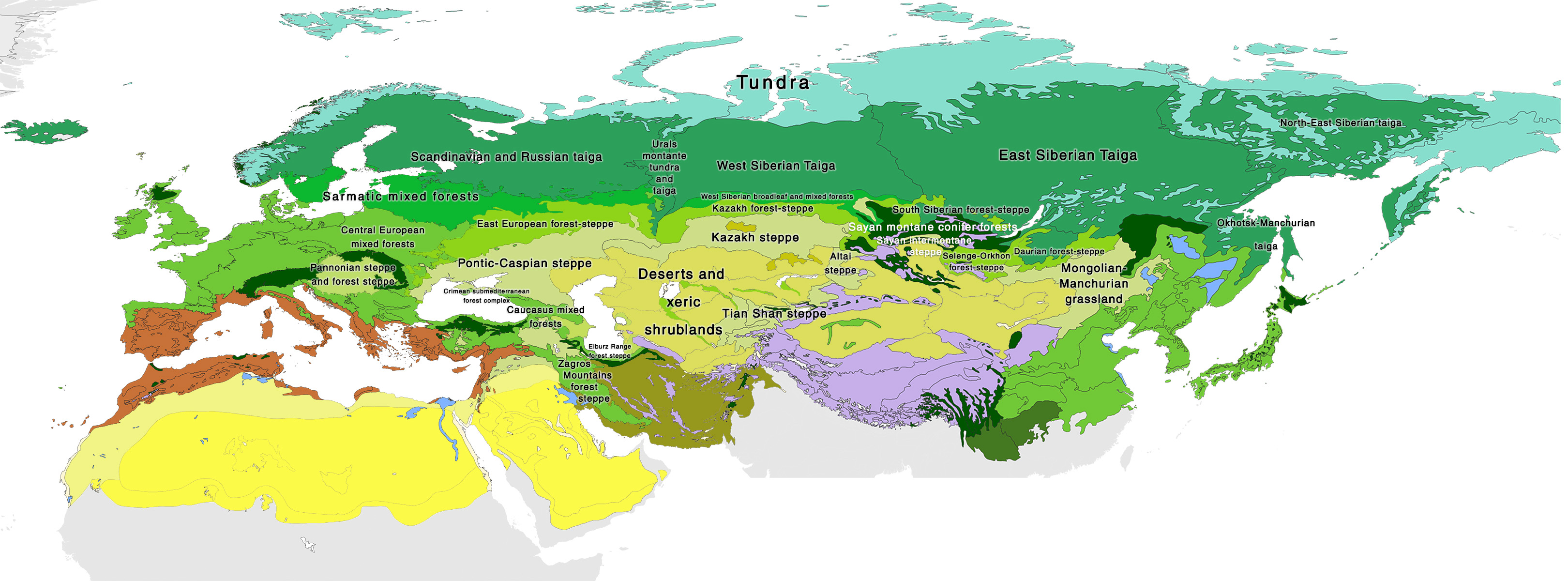
They have been drawn with Photoshop over Natural Earth raster images that are in the public domain.
![]()
You can reuse and modify the images posted here as you see fit. If you can, please cite the corresponding book and – especially if you use these high-quality images – the specific page of this website (indo-european.eu) as the source. Thank you.
 This work is licensed under a Creative Commons Attribution 3.0 Unported License.
NOTE. While the previous license was CC-by-sa, incompatible with copyrighted works and with sites like Wikipedia, I consider these new versions ‘stable’ enough to be reused anywhere, hence the new general CC-by license and the image files without labels available for download, to allow for the most common modifications.
Maps of Indo-European and Uralic migrations
Even the highest quality ones are smaller images than the originals, and they are compressed as JPEG. If you would like bigger and/or higher quality versions, a different content (with changes, omissions and/or additions), or different file formats (e.g. SVG), please write me at [email protected]. I really like to work with maps, and if the project is interesting I will probably not mind working on it.
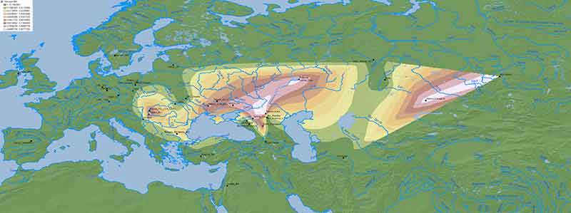
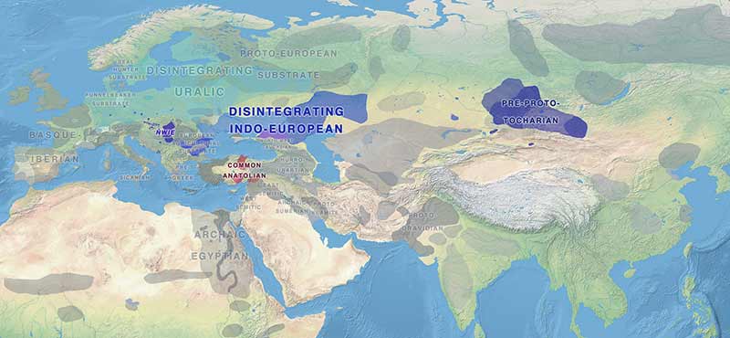
Map series of prehistoric languages
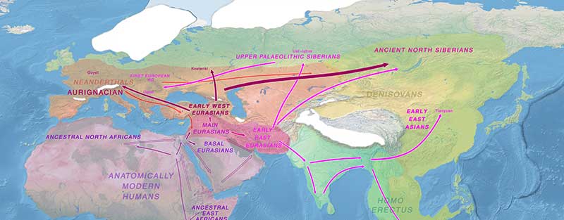
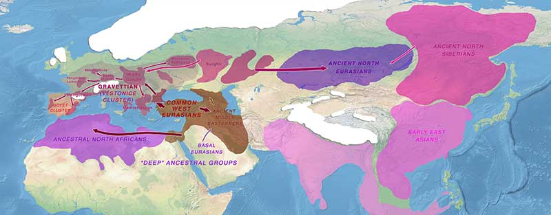
Maps of cultures and peoples by age
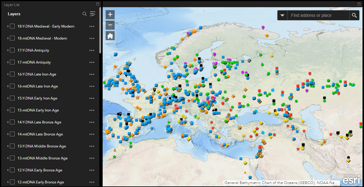
Y-DNA and mtDNA maps
Maps with Y-DNA, mtDNA, and ADMIXTURE of ancient samples are added to the different map sections above (click on one to access to the different alternative versions).
This post contains instructions for use of the ArcGIS Online WebMap of ancient samples with reported Y-DNA, mtDNA, and ADMIXTURE:
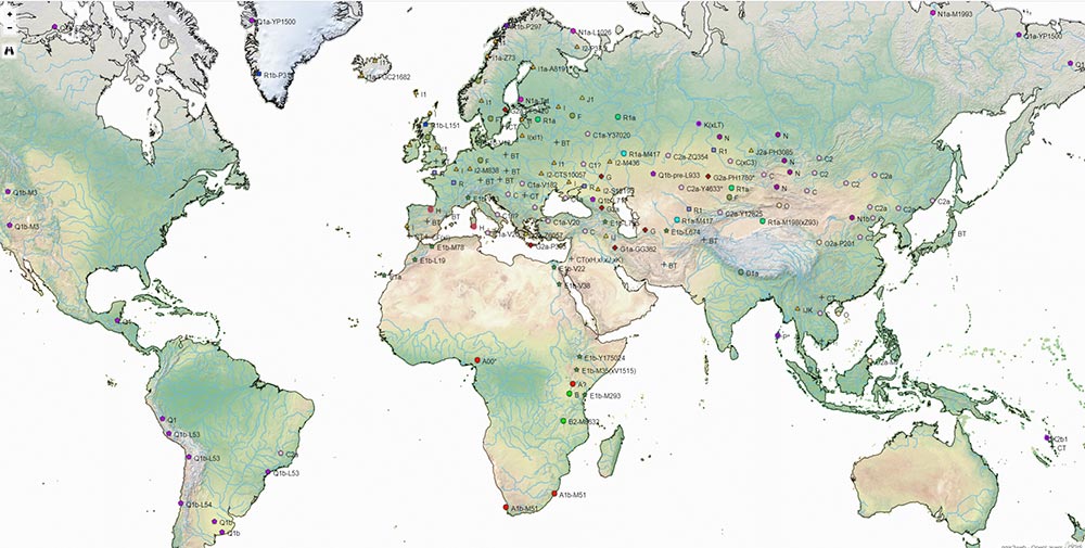
In this older post there are other available local GIS files to check ancient samples’ Y-DNA and mtDNA haplogroups:
There is a static page on maps of modern Y-DNA distribution based on the most recently published data.
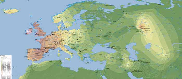
There is also a compilation of posts on maps of ancient and modern ancestry distribution based on the most recently published data.